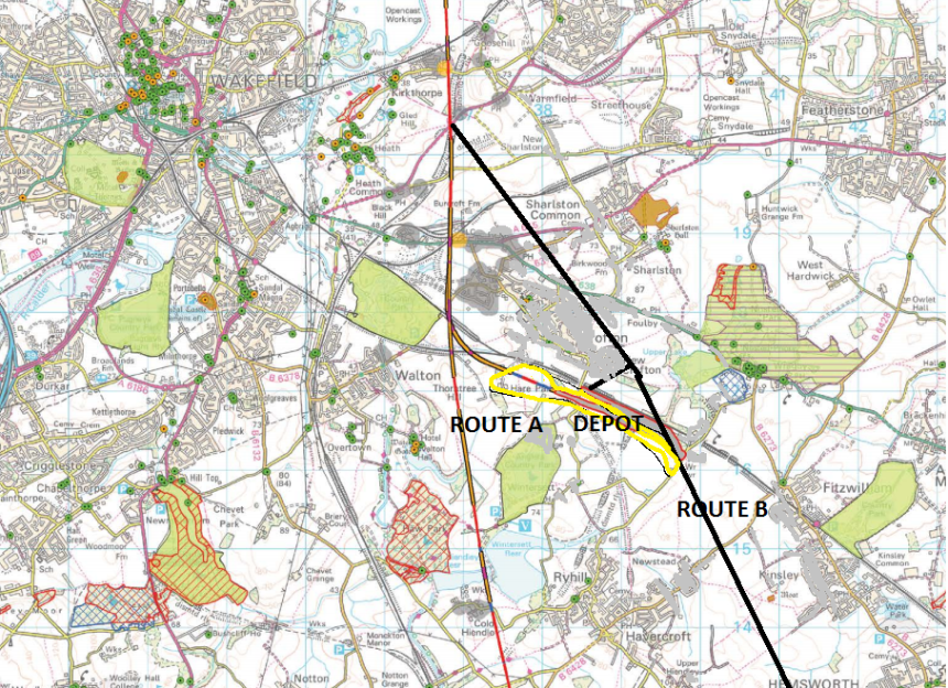
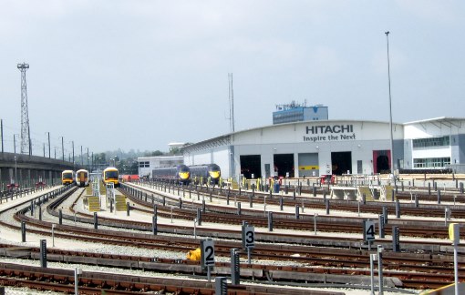
DRAFT NOISE MAP (based on 2013 HS2 original)
Below is our own draft noise map, as HS2 Limited has not done the work needed to establish this! We have projected for Crofton, Sharlston , Kinsley, hemsworth, Foulby & Nostell based on HS2 own' 2013 noise impact mapping (Grey). The New Depot is in Yellow, and new route in black and 2013 old route in Red. The light grey shading is the area of comparative noise blight equivalent to 2013 HS2 projections which now covers 90% of Crofton, compared to 20% in 2013 route. Note how the Noise will impact unacceptably close to Green areas Nostell Priory & Heronry Nature Bird Reserve. The Villages with 5 km of Crofton will face severe traffic movements by road during the 8 -10 years of construction as millions of tonnes of earth & concrete & steel & machinery are transported. Route A is the original 2013 proposed route which involved 105 demolitions & noise for 6,200 people, while the New 2016 Route would see 240+ demolitions and noise for a 5 times that number.